Climbing The Pass Of Hmong Ngo

Thailand Mountain Trail has spent several years in contact of the hill tribes to investigate the trails in the mountains of the North. In 2015 we revived many routes previously used for communicating between mountain villages and create TMT01. The 1st Thai Great Route is the longest hiking footpath of Thailand; it links Chiang Mai to Chiang Dao.
* * *
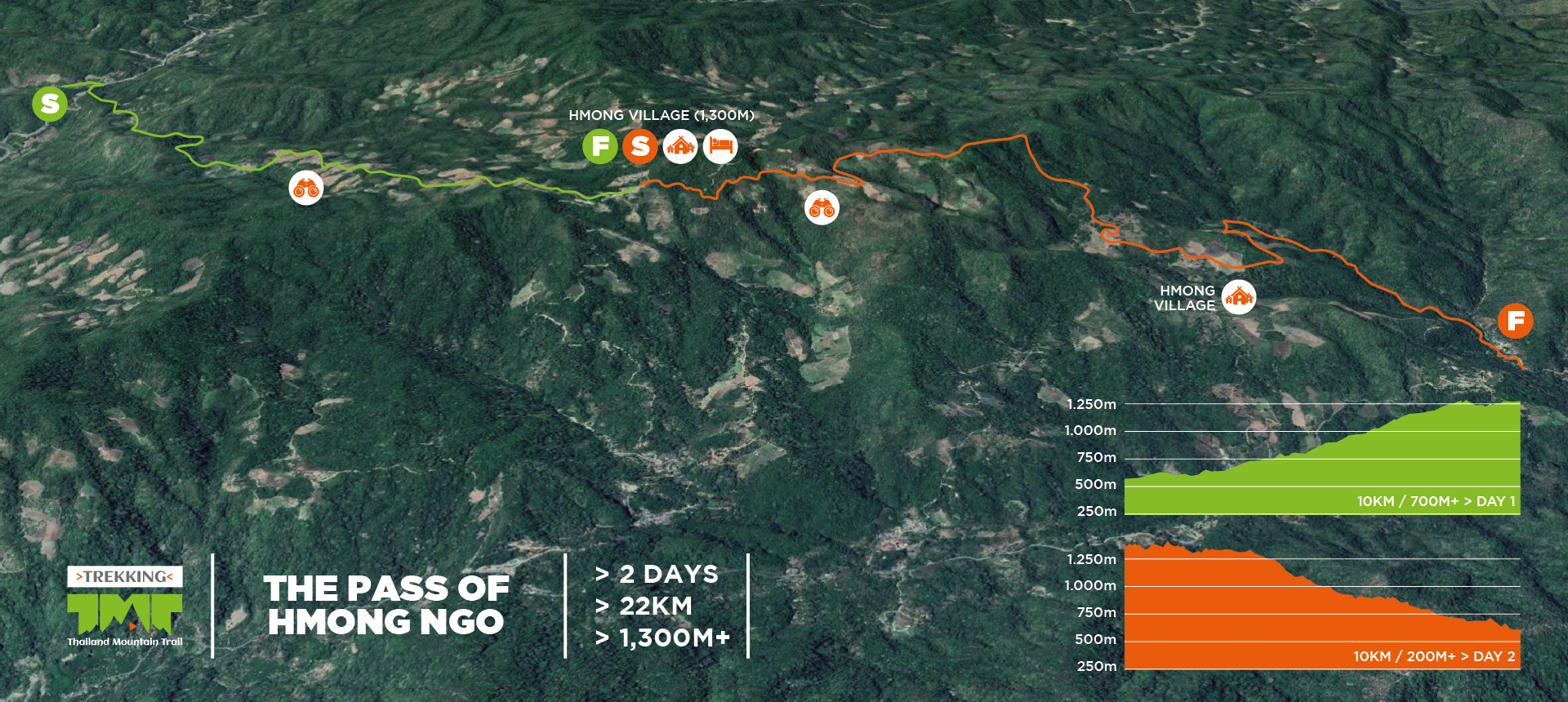
In the middle of TMT01, the objective of the trip is to reach the beautiful summit and the Hmong village of Mong Ngo located 1450m above the sea level. It’s a perfect area to discover the high mountains of Chiang Mai. The 1st day is dedicated to climb up to the top of the mountain where we will stay for one night; on the 2nd day we will cross the pass of Mong Ngo and reach a new valley through the gorges of Kio Bua Ha.
Characteristics of the Trip
6,150 THB
All-inclusive priceDuration
![]() 2
Days
2
Days
Distance
![]() 22K
22K
Elevation Gain
![]() 1300M+
1300M+
Difficulty
![]() 2 Peaks
2 Peaks
Trip Type
![]() Trek & Discover
Trek & Discover
Finish: Ban Kai Noi (1h30 transfer)
80% single-track trail, 20% double-track trail
Highlights: Jungle, Hmong villages, Summit, Gorges
1 Night at the top of the mountain
Duration: 5 hiking hours a day
Pick up & Drop off at your hotel (city center)
See details
Available: October to March
Warning: steep parts
1st Day
![]() 12K
12K ![]() 1100M+
1100M+
We start the 1st day by tackling a remarkable, dense bamboo jungle, acting as a natural frontier between Karen country and Hmong country. While the former live in the valley, the latter live in the high country. It seems Hmong people were quieter at the foothills of the summits to grow different varieties of crops.
After a long slow climb in a beautiful bamboo jungle, we hike up in the forest. The slope gets progressively harder and becomes so steep that we have to use our hands to help us at some points. Finally when we leave the depths of the forest and the horizon opens widely, we can observe the hills all around and the summit we will reach in a few hours. Soon we arrive to the Hmong village of Mong Ngo with its bamboo houses nestling against the mountainside located on a pass at 1250m above sea level. We make a break here before tackling the final summit.
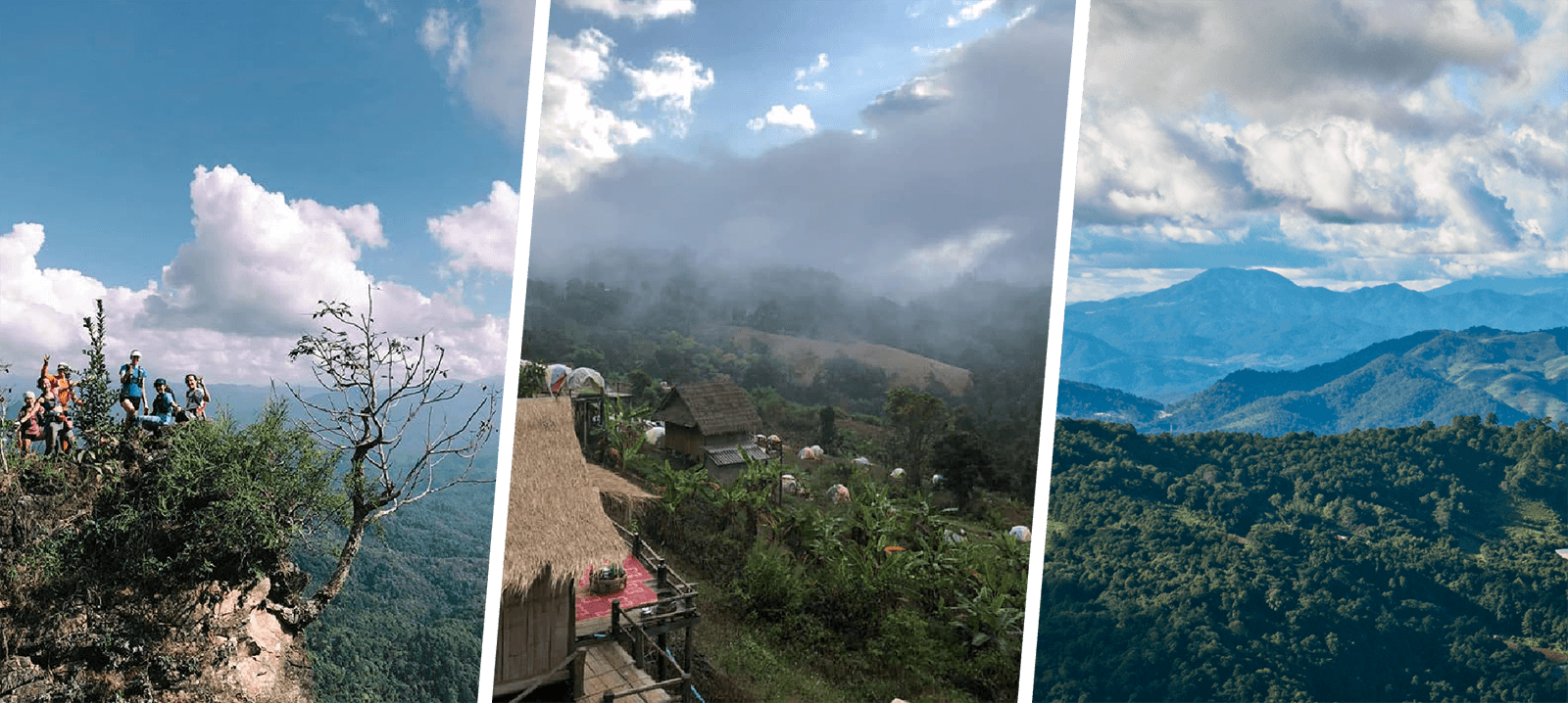
The final part to the summit is very steep but it’s worth it. At the top we are surrounded by an ocean of greenery. The view all around is imposing, far and wide. We observe precisely the next mountains of the TMT01 footpath further north. In the foreground the green hills pave the way to Chiang Dao, the highest mountain range of Thailand that appears clearly in the back. We will stay at the top for dinner and the overnight. Filled with a delightful setting and a great meal, we will spend a night the head in the stars.
2nd Day
![]() 10K
10K ![]() 200M+
200M+
In the morning of the 2nd day, we will enjoy again the scenery while having breakfast. Fortunately this setting will accompany us a few kilometers further on the dirt road we take down. When we plunge suddenly in the tropical forest, it’s a charming and wild trail that leads us to the village of Kio Bua Ha. We will stop there for lunch on a bamboo platform overlooking the small village.
After lunch we must tackle with a difficult part alongside a river inside small gorges. The best solution to move forward is to walk down directly in the river. It requires vigilance and tires the body. The atmosphere is humid and closed; vegetation is dense. We have to rest at some points but we appreciate the sense of adventure brought by this part of the route. When we finally leave the gorges, we arrive to the final village of Kai Noi.
Accommodation
Accommodation is at the top of Doi Mong Ngo located at 1450m high. We will sleep in tents and cook dinner at a fire place. It’s a unique setting for a night. The view is wide and far to the North where we will continue our trip on the 4th day. We can see clearly the summits we must reach before joining Chiang Dao that we can observe its mountain range as well. If we are lucky, in the morning we will wake up with a sea of clouds below our feet and will enjoy a cup a local coffee.


